Using Colorado’s Fishing Atlas to Plan a Trip
It's no secret that planning a fishing trip in Colorado can feel like a puzzle, especially with so many incredible rivers, lakes, and reservoirs, each with its own quirks, access points, and sometimes complex regulations. You spend hours scouring different websites, trying to piece together where to go, what fish are present, and if you can even legally cast a line. This guide will walk you through how to master the Colorado Parks and Wildlife (CPW) Fishing Atlas, transforming your trip planning from a headache into an exciting adventure.
Understanding the Colorado Fishing Atlas: Your Digital Angler's Compass
Before you even think about packing your gear or heading out the door, knowing where you're going and what to expect is half the battle. This is where the Colorado Fishing Atlas truly shines, acting as an indispensable digital companion for any angler, from the seasoned veteran to someone just starting their journey in the Centennial State. It's more than just a digital map; it's a dynamic, interactive database designed to put an incredible amount of information right at your fingertips.
More Than Just a Map: Unpacking Its Comprehensive Scope
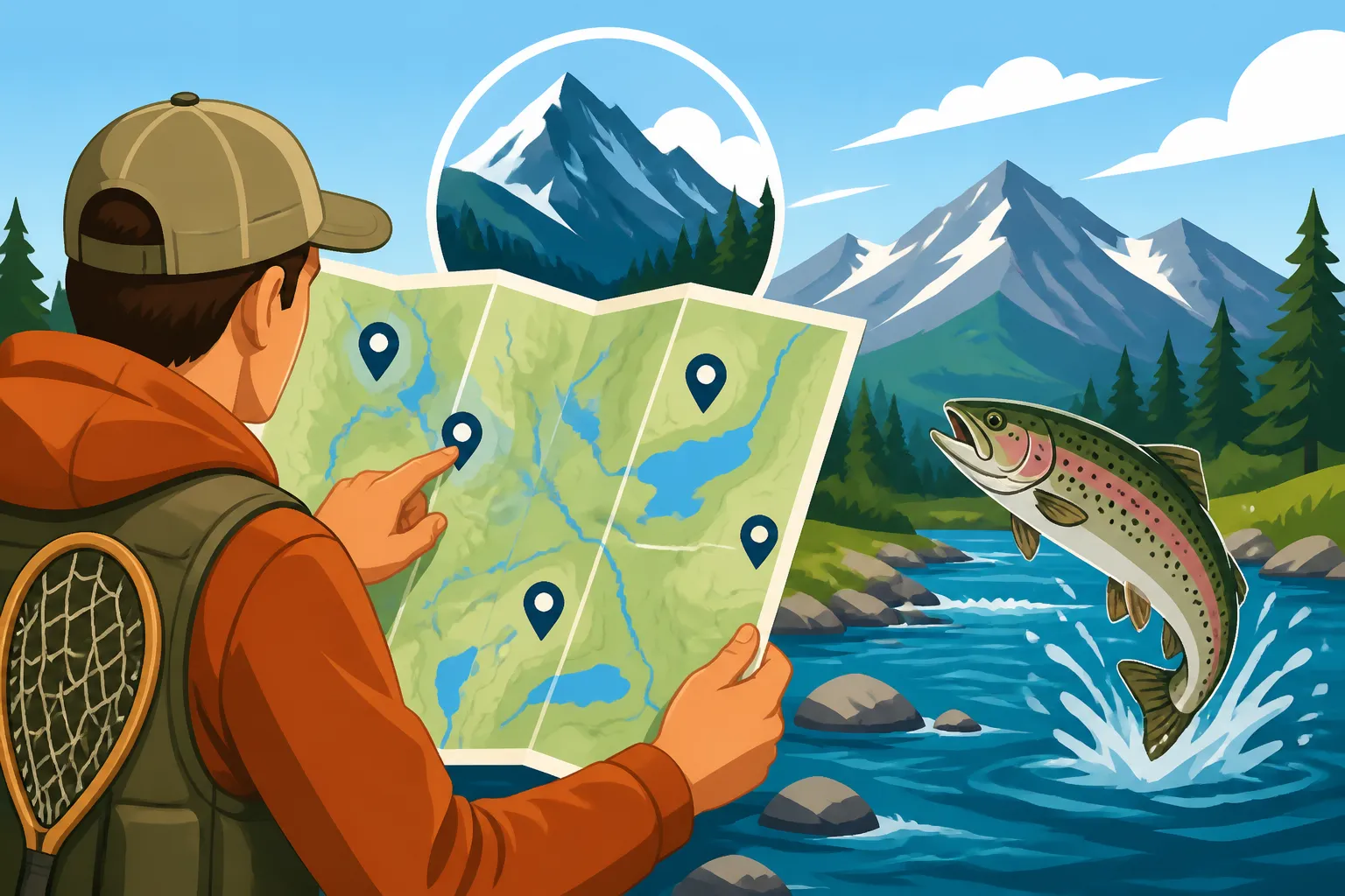
Many people hear "fishing atlas" and imagine a static image, maybe a PDF of a paper map. But the CPW Fishing Atlas is so much more interactive and powerful than that. Think of it as a comprehensive digital ecosystem that integrates mapping technology with an extensive database of fishing regulations, fish stocking reports, species presence, and crucial access information across Colorado's vast and diverse landscapes. It compiles data that would otherwise take you days to collect from various sources, presenting it in an intuitive, visual format. You can zoom in on a tiny mountain stream or pan out to view large reservoirs, all while toggling layers that reveal everything from public land boundaries to specific fishing regulations. It’s designed to answer the questions you have before you even hit the water, like "What kind of fish can I expect to catch here?" or "Are there any special rules I need to know about this section of river?" Knowing these details upfront can save you a lot of frustration and ensure you're compliant with all necessary guidelines, which, as any Colorado angler knows, can be quite nuanced. To really get a handle on all the ins and outs, it helps to understand Colorado Fishing Regulations Every Angler Should Know.
Who Benefits Most: From Novices to Nimble Veterans
The beauty of the Fishing Atlas is its universal appeal and utility. If you're new to fishing in Colorado, it's an absolute godsend. Instead of blindly picking a spot, you can use the Atlas to scout beginner-friendly lakes, identify waters that are regularly stocked, or even find urban ponds close to home. It demystifies the process of finding a good spot and helps you avoid areas that might be too challenging or regulated for a novice. For intermediate anglers, it allows for more strategic planning, perhaps finding new tributaries to explore, or researching specific species they're hoping to target. And for the seasoned veterans, those who might think they know all the best spots, the Atlas still offers incredible value. It can help confirm public access on a tricky stretch of river, provide the latest stocking updates for a favorite reservoir, or highlight newly discovered Gold Medal Waters you might not have known about. It's also an excellent tool for planning those longer, multi-day excursions into more remote areas, helping you understand the terrain, access roads, and potential camping spots well in advance. No matter your experience level, this tool significantly reduces the guesswork involved in planning a successful and enjoyable fishing trip.
Navigating the Atlas Interface: Unlocking Its Secrets
Jumping into any new digital tool can feel a bit overwhelming, especially when it’s packed with as much information as the Colorado Fishing Atlas. But don't worry, it’s designed to be user-friendly, and with a few pointers, you'll be navigating it like a pro in no time. The key is to understand the main components and how to leverage them for your specific needs.
Getting Started: Your First Steps on the Interactive Platform
To begin your adventure with the Colorado Fishing Atlas, simply head to the Colorado Parks and Wildlife website and look for the "Fishing Atlas" link. You'll be greeted by an interactive map of the entire state of Colorado. Your first instinct might be to just start clicking around, and that's fine, but taking a moment to familiarize yourself with the basic layout will save you time. On the left side of the screen, you’ll typically find a legend and a menu with various filter options. This is your control panel. You can zoom in and out using your mouse wheel or the +/- buttons on the map, and pan across the state by clicking and dragging. Don't be afraid to experiment! Click on a lake or river, and a pop-up window will appear, offering a snapshot of information about that particular water body. This initial overview often includes the water body name, general fish species present, and links to more detailed information. It’s a great starting point to get a feel for the data available and how different features respond to your interactions.
Deciphering Map Layers and Filters for Precision Planning
This is where the Fishing Atlas truly becomes powerful. The left-hand menu is crucial because it allows you to customize what information you see on the map. You’ll find categories like "Fish Species," "Fishing Access," "Water Bodies," "Land Ownership," and "Regulations." Each of these categories can be expanded to reveal a multitude of sub-layers. For example, under "Fish Species," you might be able to select specific types like "Trout," "Warmwater Species," or "Native Species," causing different icons to appear on the map highlighting where those fish are typically found. Imagine wanting to target only trout; you can filter the map to show only waters where rainbow, brown, or brook trout are present, making your search incredibly efficient. Similarly, the "Land Ownership" layer is vital for understanding public versus private access, helping you avoid accidental trespassing. By toggling these layers on and off, you can create a highly personalized view that focuses on exactly what you need to know for your trip. Want to understand what various trout species look like? A quick visit to Colorado's Trout Species, A Field Guide can help you identify them on the water after you've used the Atlas to find them.
Searching for Specific Locations or Target Species
While browsing is fun, sometimes you have a particular destination in mind or a specific fish you want to target. The Atlas has robust search capabilities to help with this. Look for a search bar, often at the top or within the left menu. You can type in the name of a specific lake, river, or even a town, and the map will automatically zoom to that location. This is incredibly useful if you’ve heard about a particular spot, like Blue Mesa Reservoir or the Fryingpan River, and want to instantly see its details. Furthermore, you can often filter your search based on fish species. If you're dead set on catching Kokanee salmon, you can input that, and the Atlas will highlight all known Kokanee waters. This targeted search function is a massive time-saver, allowing you to quickly narrow down options and gather specific intelligence without endless scrolling. It also helps you compare different potential spots side-by-side, weighing factors like reported species, access, and special regulations, ensuring your chosen destination perfectly matches your angling goals.
Key Features for Strategic Trip Planning
The Colorado Fishing Atlas isn't just a pretty picture; it's a deep well of actionable data that can radically improve your fishing strategy. Understanding its most powerful features means you can plan smarter, fish more effectively, and avoid common pitfalls.
Identifying Public vs. Private Access: Where You Can Legally Cast
One of the biggest anxieties for any angler, especially in a state with so much mixed land ownership, is knowing where you can legally access the water. The Atlas is a lifesaver here. By enabling the "Land Ownership" layer, you'll see different color-coded sections indicating public lands (like National Forests, BLM land, State Parks, and State Wildlife Areas) versus private property. Rivers often flow through a patchwork of both, and the Atlas clearly delineates these boundaries. This feature is absolutely critical because fishing on private land without permission is trespassing, which can lead to hefty fines and a ruined day. The Atlas helps you identify public easements, walk-in access programs, and designated parking areas, ensuring you start your trip on the right side of the law. You'll know exactly where to park and where you can step into the water without worry. It's a proactive measure that saves you from awkward encounters or legal trouble, offering immense peace of mind. For a deeper dive into this, check out our guide on Do You Need a License to Fish Private Water in Colorado?.
Unearthing Stocking Information and Historical Records
There’s nothing quite like the thrill of catching freshly stocked trout, especially if you’re fishing with kids or just looking for a more consistent bite. The CPW actively stocks thousands of fish into various waters across the state each year, and the Atlas often provides direct links or integrated information regarding these stocking efforts. You can usually find data on which species were stocked, how many, and when. Some sections even offer historical stocking records, giving you a sense of consistency. This is incredibly valuable because it helps you target waters that have recently received a boost, increasing your chances of success. Furthermore, understanding the stocking schedule can also help you plan trips around these events, or conversely, avoid crowded waters immediately after a stocking if you prefer a more solitary experience. Keeping an eye on the Atlas's updates ensures you're always in the loop about where the fish are being released. For even more detailed, real-time updates, you might want to look at Reading Colorado's Weekly Stocking Report.
Exploring Gold Medal Waters and Unique Regulation Zones
Colorado boasts 322 miles of "Gold Medal Waters," designated for their ability to consistently produce large trout (over 14 inches) at a rate of 60 pounds per acre, with at least 12 significant trout per acre. These are the crown jewels for serious trout anglers. The Atlas clearly highlights these Gold Medal stretches, often in a distinct color or with a special icon. But it doesn't stop there. Crucially, it also provides access to the specific regulations for these highly productive areas, which often differ significantly from general statewide rules. For example, many Gold Medal Waters are catch-and-release only, or have specific bait restrictions. Beyond Gold Medal stretches, the Atlas flags other unique regulation zones, such as "Special Regulation" waters, "Wild Trout" areas, or zones with specific bag and possession limits for certain species. Being able to visualize these areas on the map and instantly click to view their precise rules, which are critical for responsible angling, is invaluable. Ignorance of these rules is no excuse, and the Atlas makes it easy to stay informed. To really understand the nuances, our guide on Colorado's Gold Medal Water Regulations Explained is a great next step.
Assessing Water Body Conditions and Dominant Species
The Atlas often goes beyond just listing species; it can give you insights into the general health and characteristics of a water body. When you click on a specific lake or river, the pop-up information might include details about its depth, habitat type, and the dominant fish species thriving there. This is more than just a list; it helps you understand the ecosystem. For instance, knowing if a lake is primarily deep and cold might suggest targeting lake trout or Kokanee salmon, while a shallower, warmer reservoir might be better for bass or walleye. This information is key to choosing the right tackle and approach. Furthermore, some Atlas entries might link to real-time streamflow data or water temperature reports, although for the most up-to-the-minute conditions, cross-referencing with other sources is often recommended. Still, the baseline data provided by the Atlas helps you form a solid preliminary plan, ensuring you're not showing up to a shallow creek with heavy trolling gear, for instance.
Beyond Basic Mapping: Maximizing Your Atlas Potential
While the basic map functions and filter options are powerful, the true strength of the Colorado Fishing Atlas lies in its ability to empower you with comprehensive planning tools. It's about moving from simply identifying a spot to building a robust strategy for your entire trip.
Leveraging Regulation Details: Avoiding Costly Mistakes
One of the most anxiety-inducing parts of fishing in a new area is the fear of inadvertently breaking a rule. Colorado's fishing regulations can be complex, varying not just by region, but often by specific river sections or lakes. The Atlas seamlessly integrates these details directly into the map. When you select a water body, you'll find direct links or integrated text explaining the current regulations for that specific location. This can include everything from bait restrictions, length limits, daily bag limits, and possession limits for various species. Imagine finding a promising spot, clicking on it, and immediately seeing that it's "artificial flies and lures only," or that all trout over 16 inches must be released. This immediate access to hyper-local rules means you can adjust your plans and gear before you even leave home. It's a proactive way to ensure compliance and avoid potential fines or even the loss of your fishing privileges. Remember, it's not enough to just have a license; you need to understand the rules for where you're casting, and the Atlas is an invaluable aid. For a broader understanding, you should also review the official Colorado Fishing License Guide for Residents and Nonresidents.
| Feature Category | Atlas Layer/Filter | Benefit for Anglers |
|---|---|---|
| Location & Access | Public/Private Land | Identify legal fishing areas, avoid trespassing. |
| Access Points | Locate parking, boat ramps, and walk-in areas. | |
| Fish Information | Stocking Reports | Find recently stocked waters for better catch rates. |
| Species Presence | Target specific fish types (trout, bass, pike, etc.). | |
| Gold Medal Waters | Discover premier trophy trout fishing locations. | |
| Regulations | Special Regulations | Understand unique rules (catch-and-release, bait limits). |
| Bag & Possession Limits | Know how many fish you can legally keep. | |
| Amenities | Boat Ramps | Locate launching points for various watercraft. |
| Camping Areas | Plan overnight stays near your fishing destination. |
Discovering Hidden Gems: Finding Less-Pressured Waters
While it’s tempting to head to the well-known Gold Medal Waters or heavily stocked reservoirs, these spots can often be crowded, especially during peak season. The Fishing Atlas offers a fantastic opportunity to discover less-pressured waters that might fly under the radar. By using the filters creatively – perhaps looking for smaller, more remote streams or lakes, or focusing on areas without easy road access – you can unearth fantastic fishing opportunities that offer solitude and often, eager fish. You might find a small reservoir stocked annually, or a high-country lake accessible only by trail, that doesn't get the same foot traffic as the more famous rivers. This feature encourages exploration and rewards those willing to put in a little extra effort. The Atlas essentially provides the reconnaissance you need to plan an adventure off the beaten path, giving you a chance to truly experience the wild side of Colorado fishing.
Saving, Printing, and Sharing Your Custom Fishing Intel
After spending time customizing your map view, filtering for specific species, and identifying access points, you'll want to save that hard-earned intelligence. While the Atlas itself doesn't always have a direct "save custom view" feature that retains all your filters across sessions (this can sometimes depend on your browser and cookies), you can always take screenshots of your detailed map sections. For more robust planning, consider printing off key sections or even purchasing physical maps from Amazon that correspond to the areas you've pinpointed. This ensures you have a physical backup, especially if you're heading into areas with no cell service. Many anglers also find it useful to copy and paste specific regulation details or stocking reports into a personal document. If you're planning a trip with friends or family, sharing screenshots or links to specific water bodies is a great way to collaborate and ensure everyone is on the same page regarding the plan and the rules. This step solidifies your preparation and makes sure you have your vital information accessible, even when you're off the grid.
Integrating Atlas Data with Real-World Preparations
Having all this digital information is one thing, but translating it into a successful, enjoyable physical trip is another. The Colorado Fishing Atlas provides the foundational knowledge, but smart anglers integrate that data with practical considerations for their outing.
Cross-Referencing with Local Intel and Current Reports
While the Fishing Atlas is an incredible resource, it's essential to remember that conditions on the ground can change rapidly. Water flows, temperatures, clarity, and even fish behavior are dynamic. That's why cross-referencing Atlas data with current, real-world reports is a crucial step. Visit local fly shops or sporting goods stores in the area you plan to fish – places like Angler's Covey or ArkAnglers often have up-to-the-minute conditions. Check online fishing forums, social media groups, or dedicated fishing report websites. These sources can tell you if a river is blown out from recent rains, if a particular hatch is on, or if ice-out has just occurred on a high-country lake. For example, the Atlas might show a great brown trout fishery, but local reports might tell you that Colorado Fishing Seasons Month by Month means it's still too early in the year for the best action, or that runoff is making it unfishable this week. Combining the long-term, stable data from the Atlas with the short-term, dynamic information from local sources gives you the most accurate picture for your immediate trip.
Packing the Right Gear Based on Atlas-Derived Insights
The information you gather from the Atlas should directly influence what gear you pack. Knowing the predominant species and water body type is paramount. If the Atlas indicates a large reservoir known for lake trout, you'll want heavier rods, stout lines, and perhaps a selection of spoons or large swimbaits. If it highlights a small, brushy mountain stream, a lightweight rod with small dry flies or spinners would be more appropriate. You can even check average water depths for certain lakes, helping you decide if you need a sinking line or specific jig weights. This information helps you decide if you need a heavy-duty spinning rod for large lake trout, or a delicate fly rod for finicky tailwater rainbows, perhaps even ordering specialized flies or lures from Amazon. Furthermore, if you're targeting waters with "artificial flies and lures only" regulations, you'll know to leave the bait at home. The Atlas provides the crucial context for assembling a well-suited tackle box, ensuring you're prepared for the specific conditions and fish species you're likely to encounter, rather than bringing a "one-size-fits-all" setup that might be suboptimal.
Planning Your Logistics: Access, Camping, and Essential Amenities
A successful fishing trip isn't just about catching fish; it's about the entire experience, and that requires careful logistical planning. The Atlas can be instrumental here, especially when combined with other mapping tools. Use the Atlas to identify designated parking areas, boat ramps, and even nearby campgrounds if you're planning an overnight stay. Knowing if a specific access point requires a Colorado State Parks pass or if there's a fee for boat launching is crucial. Beyond the immediate fishing spot, think about amenities. Are there towns nearby for gas, food, or emergency supplies? Is there cell service, or will you need to download offline maps? The Atlas layers showing roads, trails, and nearby towns help you visualize these logistics. For example, if you're venturing into a remote section of the Gunnison River, knowing where the closest resupply point is and what kind of access roads exist (paved, gravel, 4×4 required) is paramount. Don't forget to grab a portable power bank from Amazon to keep your devices charged during your outdoor adventures. The Atlas lays the groundwork for a safe and comfortable trip by illuminating these practical considerations. For broader ideas on where to go, our guide on Colorado's Best Fishing Spots by Region can help you narrow down your search.
Addressing Common Questions and Atlas Troubleshooting
Even the best digital tools can present challenges, especially when you're in remote Colorado environments. Knowing how to troubleshoot common issues and make the most of the Atlas under various circumstances can save your trip from turning sour.
Tackling Connectivity Challenges in Remote Colorado Backcountry
One of the most common frustrations when using digital maps in Colorado's vast wilderness is a lack of cell service. You might have planned your entire trip using the Atlas at home, only to find yourself at a trailhead with no signal, rendering your digital map useless. This is a critical point where preparation pays off. Before heading into the backcountry, always anticipate losing connectivity. The best practice is to proactively save or download sections of the Atlas or convert your planned routes into a format accessible by a dedicated GPS device or a smartphone app that supports offline maps. Many mapping apps allow you to download entire regions for offline use. Print physical maps of the areas you plan to visit as a fail-safe. If you’re really serious about navigating off-grid, investing in a satellite messenger device from Amazon, like a Garmin inReach or Zoleo, can provide basic communication and location services even without cell signal, which can be invaluable for safety and navigation when the Atlas isn't accessible.
Tips for Mobile Use and Offline Access: Your Atlas in Your Pocket
Using the Atlas on your smartphone or tablet while on the move is incredibly convenient, but it comes with its own set of considerations. While there isn't a dedicated "Colorado Fishing Atlas" app, the website is generally mobile-responsive, meaning it adapts to smaller screens. However, screen size can make toggling layers and precisely identifying features more challenging. Zooming in and out might be less fluid than on a desktop.
To truly maximize mobile use, focus on planning at home and then exporting or saving key screenshots to your device's photo gallery. You can also utilize your browser's "print to PDF" function to save detailed sections with all the layers you need, which can often be viewed offline. For maps that can be downloaded for offline use through other applications, remember that these files can be large, so download them over Wi-Fi before you leave. Keeping your device fully charged, and having a portable battery pack on hand, is also paramount for mobile usage in the field, as GPS and constant screen use can drain batteries quickly.
Understanding Data Refresh Rates and Accuracy
It’s important to remember that while the Colorado Fishing Atlas is maintained by CPW, the data isn't always updated in real-time, minute by minute. Stocking reports might be updated weekly or monthly, and regulations typically change annually (though emergency closures can happen anytime). While the land ownership data and general water body information are quite stable, dynamic elements like water levels, clarity, or temporary access restrictions might not be reflected immediately. Always consider the data as a reliable baseline but be prepared for slight variations. If there’s any doubt about a regulation or access, it’s always best to consult the official Reading Colorado's Fishing Regulations Brochure or contact the local CPW office. The Atlas is an exceptional planning tool, but it's not a live sensor network. Being aware of its refresh rate limitations helps you manage expectations and reminds you to cross-reference with other current sources for the most accurate, up-to-the-minute details, especially during rapidly changing seasons like spring runoff or after significant weather events.
Disclaimer
Please remember that fishing regulations, access points, and stocking schedules can change. Always consult the official Colorado Parks and Wildlife website and current regulations brochure before your trip to ensure compliance. This guide is for informational purposes only and does not supersede official state regulations.