When Alpine Lakes Above 11,000 Feet Thaw Out
There’s a special kind of anticipation that comes with planning a high-country fishing trip in Colorado. You dream of crystal-clear waters, stunning peaks, and hungry cutthroat trout, but then the nagging question sets in: Is it even thawed yet? Trying to time your trip to those incredible alpine lakes above 11,000 feet can feel like a guessing game against Mother Nature. This guide is here to help you understand the dynamics of their annual thaw, so you can plan your adventure with confidence and avoid the disappointment of a frozen paradise.
The Unique Challenge of High Alpine Lakes
Fishing Colorado's high alpine lakes isn't just about the stunning scenery; it's about navigating an environment that operates on a completely different timetable than the lower elevation rivers and reservoirs. These lakes, often nestled in cirques or high glacial valleys, are truly at the mercy of intense winter conditions and slow-to-retreat snowpacks. The very characteristics that make them so wild and pristine are also what make their accessibility a seasonal puzzle.
Elevation's Impact on Thaw
It's no secret that as you climb higher in elevation, temperatures drop. This fundamental meteorological truth is the primary reason why lakes above 11,000 feet hold onto their ice long after the streams in the valleys are flowing freely and the lower reservoirs are humming with boat traffic. For every 1,000 feet you ascend, the air temperature generally drops by about 3.5 degrees Fahrenheit. So, while Denver might be enjoying 70-degree days in May, a lake at 11,500 feet could still be experiencing daytime highs barely above freezing.
This sustained cold means that the ice on these lakes is often many feet thick, accumulated over a long, harsh winter. It's not just a thin sheet; it's a formidable block of frozen water that requires consistent, strong solar radiation and warmer air temperatures to break down. The shorter summer season at these altitudes also means less time for the ice to melt, making the window for open water fishing incredibly precious and often brief.
Microclimates and Snowpack Variability
Even within the same mountain range, or sometimes just a few miles apart, you’ll find significant differences in when high alpine lakes finally shed their icy covers. This is due to localized microclimates and the highly variable nature of mountain snowpack. One lake might be on a south-facing slope, soaking up direct sunlight for most of the day, while another, just over a ridge, sits in the perpetual shade of a north-facing cirque. The shaded lake will almost always thaw later and freeze earlier.
Furthermore, snowpack isn't uniform. A particularly windy winter might scour one basin nearly clear of snow, while dumping immense drifts into another, leading to stark differences in the amount of lingering ice and snow that needs to melt before the lake can even begin to warm. This means you can't just assume two nearby lakes will be open at the same time; each one has its own unique set of circumstances that dictate its thaw.
Typical Thaw Timeline for 11,000+ Foot Lakes
Understanding the general timeline for these high-altitude wonders can help you set realistic expectations for your fishing adventures. Remember, these are broad averages, and actual dates can shift significantly year to year depending on the specific winter and spring conditions.
Early Season Melt Out Late June to Early July
For most high alpine lakes above 11,000 feet, the very first signs of significant ice melt usually begin in late June, stretching into early July. This isn't a sudden, dramatic event, but rather a gradual process. You might see open water around the edges where the sun hits the shore or where feeder streams are pushing in warmer water. Sometimes, a "moat" will form around the perimeter while the main body of the lake remains frozen solid.
During this period, access trails themselves might still be covered in deep, lingering snowdrifts, making the hike in challenging, if not impossible, without proper gear like snowshoes or microspikes. Anglers venturing out this early should be prepared for mixed conditions – slushy snow, muddy trails, and partial ice cover on the lake. Fishing can be productive in the newly thawed areas, as hungry trout will often cruise the margins looking for early insect activity or terrestrial insects that have fallen into the water. However, the window for casting can be quite limited.
Peak Open Water Mid-July to August
This is the golden window, the prime time when most high alpine lakes in Colorado are completely, or at least mostly, ice-free. Typically from mid-July through the end of August, these lakes offer their most inviting conditions. The trails are usually clear of snow, though stream crossings can still be high from snowmelt. The water temperatures have risen enough to really activate the trout, leading to more consistent feeding and exciting dry fly opportunities.
During these weeks, the lakes are at their most accessible and enjoyable. You'll find a richer insect life, from various midges and caddis to occasional stoneflies and even terrestrials like grasshoppers and ants making their way to the water. This is when you can truly spread out, explore different sections of the lake, and enjoy the full alpine experience without the constant worry of ice. It's often when you’ll hear about the biggest fish being caught, as the trout are actively feeding and putting on weight after the long winter. This is also a great time to explore other regions, like if you're fishing the Rio Grande Near South Fork or checking out the fishing the Arkansas River Through Salida.
Late Season Freeze-Up September to Early October
Just as quickly as it arrives, the open water season in the high country begins to wane. By September, especially as you move into late September and early October, colder nights become more frequent, and daytime temperatures start to drop significantly. You'll notice the change in the foliage as the aspens turn brilliant gold, signaling the shift.
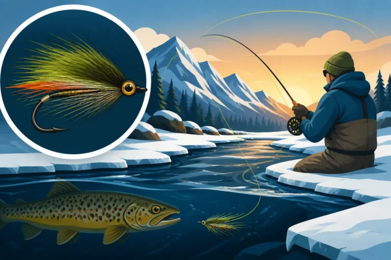
This is when the process of freezing starts to reverse. New ice might form overnight in calm, shallow coves, only to melt away by midday. However, as the month progresses, these icy patches become more persistent, eventually starting to cover larger portions of the lake. Snowfall also becomes a real possibility at these elevations. While early fall can offer some incredible fishing as trout gorge themselves before winter, anglers must be prepared for rapidly changing weather, including sudden snowstorms and freezing conditions. Access trails can become slick with ice or mud, and the likelihood of finding open water diminishes rapidly as October approaches. For those interested in the full cycle, learning about Ice Fishing in Colorado, Getting Started can provide valuable insight.
Factors Influencing Thaw Dates
Predicting the exact moment an alpine lake will thaw is incredibly difficult, almost impossible, due to the multitude of environmental variables at play. It's not a fixed date on the calendar, but rather a dynamic response to the season's unique conditions.
Annual Snowpack Depth
The amount of snow that accumulates over the winter is perhaps the single biggest factor determining when a high alpine lake thaws. A winter with an exceptionally deep snowpack means several things:
- More Ice Mass: Deeper snow insulates the ice on the lake, keeping it colder for longer. Think of it as a thick blanket that prevents the sun's warmth from penetrating.
- Delayed Access: The trails leading to the lake will be covered by snow later into the season. Even if the lake itself is starting to melt, getting there might be an arduous trek through deep, consolidated snowfields that hide stream crossings and trail markers.
- Persistent Ice Formations: Larger snowdrifts near the lake shore can melt slowly, feeding cold water into the lake and actively chilling it, further slowing down the overall thaw.
Conversely, a low snowpack year, which Colorado has seen with increasing frequency, means earlier thaw dates. With less snow to insulate the ice and shorter periods of snow on the trails, lakes can become accessible and open up weeks ahead of schedule. Always consult resources like the NOAA snow water equivalent maps to get an idea of how the current year's snowpack compares to historical averages.
Spring and Early Summer Temperatures
Beyond the depth of the snow, the intensity and duration of spring and early summer temperatures play a crucial role. A series of warm, sunny days with minimal cloud cover can dramatically accelerate ice melt. Strong solar radiation, coupled with air temperatures consistently above freezing, will erode the ice from the top down and around the edges.
However, a cold, wet spring with frequent late-season snowfalls or prolonged periods of overcast skies will significantly delay the thaw. Even if the snowpack wasn't historically deep, persistent cool weather can keep those high lakes locked up tight. It's a delicate balance; one late-spring cold snap can undo weeks of progress, extending the ice season well into July. This variability is why it's so important to check local conditions, much like you would if you were considering Colorado's March Trout Stocking, What to Expect at lower elevations.
Aspect and Surrounding Topography
The orientation of the lake within its basin – its "aspect" – profoundly affects how much direct sunlight it receives.
- South-facing Lakes: Lakes nestled on south-facing slopes, or in wide-open bowls that get full sun exposure for most of the day, will almost always thaw earlier than those in shaded areas. The sun's energy is a powerful force for melting ice.
- North-facing Lakes: Lakes that sit against north-facing cliffs or steep slopes are often shrouded in shade for a good portion of the day, especially in the early morning and late afternoon. These lakes will hold ice for much longer.
- Deep Cirques: Lakes tucked away in deep, narrow cirques, surrounded by high peaks, will also see delayed thaws. The peaks themselves cast long shadows, limiting direct sunlight even on clear days.
The topography can also funnel wind, which can either help break up ice or, if the wind is cold, actually hinder melting. This level of detail about a specific lake is something you often only learn from experience or from talking to local experts.
Lake Size and Depth
Finally, the physical characteristics of the lake itself influence its thaw.
- Smaller, Shallower Lakes: Generally, smaller and shallower alpine lakes will thaw out faster. There's less volume of water to warm up and less ice mass to melt. Their shallowness also means sunlight can penetrate more effectively, warming the lakebed and contributing to ice decay.
- Larger, Deeper Lakes: Conversely, vast and deep alpine lakes, like those you'd find in the Holy Cross Wilderness or the Indian Peaks Wilderness, take considerably longer to thaw. They hold a massive volume of cold water and a huge mass of ice. It requires sustained warmth and sunlight to penetrate to their depths and melt the entire ice layer. These lakes can sometimes have lingering ice into late July or even early August in heavy snow years.
How to Determine Current Conditions Before You Go
So, how do you avoid hiking miles into the wilderness only to find your dream lake still a sheet of ice? Planning is everything when it comes to high alpine fishing in Colorado. There are several excellent resources and strategies you can use to get the most up-to-date information.
Utilizing Online Resources
The internet is your best friend when researching high-country conditions.
- Colorado Parks and Wildlife (CPW): While CPW doesn't typically provide real-time ice-off reports for every high lake, their website is invaluable for general conditions, alerts, and regulations. They might have advisories about specific areas or provide an overview of snowpack impact on the season. Their Colorado Fishing License Guide for Residents and Nonresidents is also a must-read before heading out.
- National Weather Service (NWS) / NOAA: Check the forecast for the specific elevation of your target lake, not just the nearest town. High-elevation forecasts will give you a much more accurate picture of air temperatures, overnight lows, and precipitation chances. NOAA's interactive snow water equivalent (SWE) maps can show you current snow depths compared to average, giving you an indicator of whether it's a heavy or light snow year.
- USDA Forest Service / BLM Ranger Districts: These agencies manage most of the public land where alpine lakes reside. Their websites or, even better, a direct phone call to the local ranger district office, can provide crucial intel on trail conditions, snow levels, and any recent reports from hikers or rangers. They often have the most current, on-the-ground information about specific trails and lakes.
- Hiking and Backpacking Forums/Apps: Websites like AllTrails, Gaia GPS, or various hiking forums often have recent user reports. People will post conditions, including whether lakes are thawed, how much snow is on the trail, and river crossing difficulties. Look for reports from within the last week or two for accuracy. This is also where you might learn about specific hazards, such as the need for Barbless Hook Rules on Colorado Rivers if your approach trail follows a river.
Consulting Local Experts and Outfitters
While online resources are fantastic, nothing beats the wisdom of local experts who are on the ground daily.
- Local Fly Shops: These are often the absolute best source for real-time, hyper-local information. Shops like Trouts Fly Fishing in Denver, or The Blue Quill Angler in Evergreen, frequently have guides and staff who are out on the water, or hear reports from clients. They can tell you exactly what's open, what flies are working, and what the access is like. Even if they don't guide directly at your specific high lake, they’ll know general conditions for that region.
- Outdoor Gear Stores: Retailers like REI or local independent gear shops often have knowledgeable staff who are also avid hikers and anglers. They can offer insights into trail conditions, recommend appropriate gear, and may have heard recent reports from other customers.
- Guided Trip Operators: If you're considering a guided trip, the outfitter you contact will have the most up-to-date information, not just on thaw dates, but on what kind of experience to expect. When considering Hiring a Fishing Guide in Colorado, What to Expect, they'll certainly be able to advise you on lake conditions.
Interpreting Satellite Imagery and Webcams
For a visual confirmation, satellite imagery can be surprisingly useful, especially from late June onward.
- NOAA/NASA Satellite Images: Websites that display current satellite imagery (e.g., from the MODIS system) can sometimes show clear enough images to discern if a larger high-alpine lake still has ice cover. Look for cloud-free days. While not always high-resolution enough for every small tarn, it's a good tool for bigger bodies of water.
- Mountain Pass Webcams: While not directly showing lakes, webcams at high mountain passes (like Loveland Pass, Berthoud Pass, Cottonwood Pass) can give you a general idea of the snow levels and weather conditions in the high country. If the passes are still buried in snow in mid-July, it's a good bet the lakes above them are too. This provides a crucial visual component to complement temperature data.
Safety Considerations for Early Season Alpine Fishing
Venturing into Colorado's high country, especially during the early season thaw, isn't just about finding open water; it's also about staying safe. The mountains are beautiful but unforgiving, and conditions can change rapidly.
Avalanche and Snow Travel Risks
Even in late spring and early summer, lingering snowfields in the high country pose significant risks.
- Avalanche Danger: While peak avalanche season is typically winter and spring, wet-slide avalanches can occur later in the season as snow warms up, especially on steep slopes. Always check the Colorado Avalanche Information Center (CAIC) reports, even if it feels "too late" for avalanches.
- Hidden Hazards: Snow bridges over creeks can collapse, creating dangerous traps. Post-holing (sinking deep into soft snow) can be exhausting and lead to injuries, especially if you step into a hidden void between rocks. Always consider bringing snowshoes or microspikes if there's any chance of significant snow on your trail, and an ice ax might be necessary for steep, icy traverses.
- Route Finding: Trails can be completely obscured by snow, making route-finding challenging. Always carry a map and compass, or a reliable GPS device with downloaded maps, and know how to use them.
Variable Weather and Gear Preparedness
The weather in the Colorado high country is notoriously fickle. A sunny morning can turn into a raging thunderstorm with hail, lightning, and plummeting temperatures in a matter of minutes.
- Layer Up: Always dress in layers, using synthetic or wool materials that retain warmth even when wet. Cotton is a definite no-go. Pack extra layers, including a waterproof and windproof outer shell, even if the forecast looks clear. You can find excellent layering options on Amazon.
- Emergency Supplies: A "ten essentials" kit is non-negotiable. This includes navigation tools, sun protection, insulation, illumination, first-aid supplies, fire starter, repair kit/tools, extra food, extra water, and emergency shelter.
- Turn Around if Necessary: Never hesitate to turn back if the weather turns bad, if conditions become too difficult, or if you feel unprepared. A fish isn't worth risking your safety. Knowing When Colorado's Spring Runoff Hits and How to Fish Around It for rivers can also give you insight into the general mountain conditions.
Water Temperature and Wading Dangers
Even when thawed, alpine lake water remains incredibly cold throughout the summer.
- Hypothermia Risk: Falling into frigid water can lead to rapid hypothermia. If you plan to wade, good quality waders are essential. Be mindful of unstable footing near the shore, especially where ice might have recently receded, leaving soft or undercut banks.
- Water Levels: Early in the season, snowmelt can lead to higher than usual water levels in feeder creeks and rivers, making crossings more challenging and dangerous. Always assess stream crossings carefully and consider alternative routes if they appear too hazardous.
The beauty and solitude of Colorado's alpine lakes are truly unparalleled, offering some of the most rewarding fishing experiences in the state. But respecting their unique environment, especially during the dynamic thaw period, is key to a successful and safe adventure.
| Lake Elevation (Approx.) | Typical Thaw Window (Average Year) | Key Factors | Access Challenges | Recommended Preparedness |
|---|---|---|---|---|
| 11,000 – 12,000 ft | Late June – Mid-July | Snowpack, Aspect, Spring Temps | Lingering snow on trails, muddy sections | Layers, waterproof gear, microspikes/snowshoes (early) |
| 12,000+ ft | Mid-July – Early August | Heavy Snowpack, Lake Depth, Shade | Deep snow, potential for avalanche paths, difficult route finding | Advanced navigation, avalanche awareness, appropriate footwear |
| All Alpine Lakes | Variable Year to Year | Snowfall, Sustained Warmth, Wind | Unpredictable weather, cold water, limited open water initially | Emergency kit, detailed maps, local reports, flexible plans |
Disclaimer
Please note that fishing regulations, conditions, and access can change rapidly in Colorado. Always consult the official Colorado Parks and Wildlife (CPW) website and local land management agencies for the most current information before planning any fishing trip. This guide is for informational purposes only and should not replace official sources or professional advice.